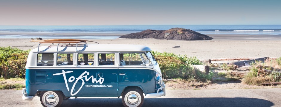
Tofino and Clayoquot Sound
Tofino, at the gateway to Clayoquot Sound & on the wild west coast of British Columbia, is paradise for the paradise seeker. Stroll along one of the many boardwalks in Pacific Rim National Park & revel in the majesty of one of the world’s largest temperate old growth rainforests. Each year, over 20,000 Gray Whales migrate past Tofino on their way north. Surf the waves at Long Beach, kayak the islands of Meares, Flores & Vargas, take in a whale watching or harbour tour, try your luck at deep sea fishing, discover the marine life while snorkeling or scuba diving, then water taxi to Hot Springs Cove for a relaxing soak.
Looking for some things to do in Tofino? Interested in whale watching, kayaking, bear watching, surfing or other eco-tours? We have it all at HI-Tofino, Whalers on the Point Guesthouse! Our guests receive up to 10% OFF all Eco-Tours offered through our participating Discount Partners. Click here to check out our discounts!
__________________________________________________________________________________________________________________________________________________________
PARKS, BEACHES, TRAILS IN & AROUND TOFINO
Tonquin Park
This is Tofino’s closest beach and nature park, and is a short 15 minute walk from ‘Whalers’. You will descend about 75 steps down a boardwalk onto a beautiful sandy ocean beach. The trail leads through the rainforest, and you’ll see many plants along the way. This isn’t a very large beach but it does get lots of sun and offers great views of the sunset. Tonquin Park is also a great spot to watch for gray whales, who like to come and scratch their tummies on the sandbars. There are also some great tidal pools where you can see starfish, mussels, & sea anemones, and also a few small cave like crevises. Open campfires are permitted here.
MacKenzie Beach
This is the next closest beach, about 3 km south of Tofino. Lots of sand and full sun makes this beach popular.
Chesterman's Beach and Cox Bay
Two of our local surf beaches located 4 km south of Tofino. Great beaches to view the sunset and when the tide is low, you can walk out to a small island just off from Chesterman Beach.
Pacific Rim National Park
Set aside in 1970, to protect the coastal rainforest, surf-swept beaches, marine life, and the cultural history of the area. There are three separate units of the National Park: Long Beach, the Broken Group Islands, and the West Coast Trail. The Long Beach Unit with one of the world’s largest temperate rainforest, offers many things to enjoy:
(a) Wind your way along one of the many trails & boardwalks, exploring the gigantic trees and ancient fallen logs in the old growth rainforest…at the top of Radar Hill you can enjoy the panoramic views of the Clayoquot Sound, along with the historical monuments. Many mammals and birds habitat the area, and you’re likely to see some of them: raccoon, mink, & black bear, as well as hundreds of species of birds including the bald eagle and the blue heron.
(b) The Wickaninnish Centre overlooks beautiful Wickaninnish Beach… the centre run by Parks Canada provides free exhibits and hourly movies that explore the natural and cultural history of the Pacific Rim. On display are: a whaling canoe, a gigantic mural depicting ocean life, and some whale and other mammal bones.
(c) Long Beach, Combers Beach, Schooner Beach, and Wickaninnish Beach… famous as the longest stretch of surf swept sand on the west coast.
Radar Hill
Originally built as a radar installation during WWII. From this vantage point, you will have excellent panoramic views of the Clayoquot Sound including Meares, Flores and Vargas Island. There are two distinct viewing areas to take in when visiting Radar. The first offers a postcard perfect view down the hill and beyond to the open Pacific. The second viewing area offers views of the surrounding inlets and islands.
Radar Hill Beach
The trail down from Radar Hill to the beach is a challenging trail, and is quite vertical. When you emerge from the forest near the bottom, a large lazy stream of freshwater greets you to your left and a pristine sand beach bowl is in front of you. This beach is also known by the locals as "Nude Beach".
Schooner Beach Trail
Mostly boardwalk, the trail winds through cedar and hemlock trees, ascending and descending through a couple of gullies and cross a small bridge. Near the end of the trail, you will descend about 60 stairs to the beach. Once on the beach, if you head to your left past the First Nation Reserve of Esowista, you can walk south to Long Beach.
Long Beach
Just as its’ name indicates, you can walk 10km along the beach & still not reach the end. Long Beach is actually divided into three beaches: Long Beach, Combers Beach and Wickaninnish Beach. The flat sand and beautiful view of the Pacific make for easy walking, wonderful scenery, and incredible sunsets. This is also a great place to watch surfers, as the huge waves roll in.
Spruce Fringe Trail
The entire trail is on an elevated boardwalk that allows you to see the natural state of the forest without doing any damage to the soil. The trail leads through a crab apple bog where you’ll see Sitka Spruce, Hemlocks, and Cedar trees. The Sitka Spruce is unique to this trail as it is one of the few trees that is capable of surviving the salty mists and sand-ridden winds of the open Pacific.
Combers Beach
This is another part of Long Beach and is usually the least busy. You’ll notice what the destructive force of the surf has done to the parking lot, with all the wave and tidal erosion. This beach is very interesting with large accumulations of driftwood.
Rain Forest Trail
This is another part of Long Beach and is usually the least busy. You’ll notice what the destructive force of the surf has done to the parking lot, with all the wave and tidal erosion. This beach is very interesting with large accumulations of driftwood.
From the parking area, you will see Trail “B” first. The trail begins at an old clearing through a cedar and hemlock thicket and finally to the old growth forest. As you descend farther into the forest you are left with amazing silence and awe of a classic rainforest. You will cross over a bridge made from a single old growth log, and will encounter interpretative signs that help explain how the rainforest regenerates itself.
Trail "A" is on the other side of the highway. It is essentially the same type of old growth forest found on Trail “B” except that this trail will take you farther up and down the gullies. Expect to encounter about 150 steps. You’ll find interpretative signs along the trail, and there’s some good examples of the very old ‘nurse’ logs. This trail will take you over a salmon stream with excellent viewing opportunities.
Shoreline Bog Trail
This is probably the easiest walking trail in the park. It is entirely made up of boardwalk and is completely flat and wheelchair accessible. What makes this trail so interesting is the bog, that allows only certain types of vegetation to grow. Here you will find stunted shore pines that are several hundred years old.
South Beach Trail
This trail begins just behind the Wickaninnish Centre and restaurant at Long Beach. Watch for the wheelchair ramp and continue south along this path. The trail winds past Lismer Beach, then continues along a boardwalk. After about 5 minutes walking you will pass another beach, then a short while later you’ll arrive at a beach where you can view some big waves. Even on mild days, the waves at this beach are funnelled between large rock walls and are rarely less than 5 or 10 feet in height. Be sure to keep well away from the rocks, as rogue waves are not uncommon, and have been known to carry people out to sea. If you want photographs of the big waves crashing on rocks this is your place.
Florencia Bay
This beach was named after the ship Florencia that wrecked, early in the last century, and from the 1870’s onwards, was known as “Wreck Bay”. Here you will notice the large sand cliffs and boulders. Normally quieter than Long Beach, this beach offers swimming, surfing, and sunbathing.
Wickaninnish Interpretive Centre
Originally the site of a spectacular hotel that accommodated many guests for several decades before the advent of the Park, the Centre is now home to a museum, theatre, and restaurant. There are several displays on aboriginal life including a large traditional native canoe. There is a whale display with videos, bones and sculpture. During the spring, summer, and fall, you can view short educational movies in the theatre. The Centre also has a huge mural depicting a gray whale and other marine life found in the National Park. Also at the Centre are washrooms and public telephones. Admission is free. But remember to get your parking ticket for your car. The Centre is open from early spring until mid fall.
Wickaninnish Trail
This trails links Florencia Bay and Long Beach. The trail passes through old growth forest dominated by Sitka spruce. There is one small bridge across a gully and in the rainy months, you can expect to have to jump over some fairly large puddles. As the soil becomes more acidic, the forest gives way to a bog that is primarily made up of shore pine. Originally used by the first nations people, the trail was upgraded with wood poles laid across the path, when the pioneers arrived. As crude as it was, Model T’s could drive the entire distance over this “corduroy trail”, so termed because of the resemblance to the fabric. About half way through this trail, you will see and walk over sections of the original trail. Soon, an incline boardwalk will lead you up and out of the bog into a new growth forest. At this point, you will begin to hear the surf of Florencia Bay.
Gold Mine Trail
In contrast to the surrounding old growth forests, this trail leads through an area logged in the 60’s. An attempt to plant the area with Douglas Fir failed, because of a lack of specific nutrients in the soil. The forest is similar to one that you would find in the east; very dense with medium sized trees that have not yet lost their lower branches in their fight to compete for the light. The big difference in this forest however are the looming sculptures of stumps, some 10 feet high, which once were massive 800 year old trees. At the very end of the trail, just after you cross the salmon stream by bridge, are iron remnants from the early 1900’s when this creek was panned for gold. When you get to the beach, on your left about 30 feet away you will see a totem. A family of hippie squatters built this back in the 60’s to mark the spot where they lived until the Park was proclaimed and the houses were demolished in the early 70’s. Although the totem is not traditional First Nations, it now holds a place in the history and evolution of the national park.
Willowbrae Trail
Most travel at the turn of the century was done by water due to the rugged terrain. This trail served as the overland route between Ucluelet & Tofino and is part of the original “corduroy” road. To access the start of the trail you have to drive south, past “the junction” and turn right on Willowbrae Road. A few minutes up this road will lead you to a parking lot and the start of the trail. This trail is essentially flat and it passes through a forest logged at the turn of the century. When you reach the small bridge near the end of the trail go right, then descend a steep hill and you’ll find yourself at the southern end of Florencia Beach.
Half Moon Bay Trail
If you follow the same directions for the Willowbrae Trail, turn left when you reach the small bridge. This will take you through a dense forest. Soon you will find yourself nearing the edge of the forest, and it will change to a grove with giant Sitka Spruce that rely on the ocean fog for nearly 20% of their nutrients. After descending a 100 foot wooden ramp and stairs, you will arrive at the most southerly point in the Long Beach Park. From this small beach, you can enjoy the spectacular vista views of Florencia Bay.
UCLUELET & AREA
Just a half-hour drive from Tofino, you’ll find the town of Ucluelet. Pronounced "YOU-CLUE-LET", this name originally applied to a First Nations village located on the east side of the entrance to Ucluelet Inlet; the name means “safe harbour”. In the1860’s, European fur sealers established the present site of Ucluelet, on the West Side of the inlet. Originally Ucluelet was accessible only by sea. Packet steamers operated by the Canadian Pacific Railway connected Ucluelet with Victoria. The road that now connects Ucluelet to Tofino was opened during World War II and was paved and made public in 1959. Early industries included: fur sealing, sawmills and logging. With the establishment of Pacific Rim National Park Reserve, Ucluelet is fast becoming a destination for visitors from around the world. While visiting Ucluelet, discover the scenic Amphitrite Point & Lighthouse, the Wild Pacific trail, and He-tin-kis Park. You can also visit the Thornton Creek hatchery. Shuttle transportation from Tofino is available.
Big Beach Trail
This popular trail, used mainly by Ucluelet locals, has recently been expanded. The boardwalk has been upgraded, and a new cedar gazebo provides shelter from the rain. One of the highlights of the trail is a red cedar that has grown four separate trunks giving it a "devil’s fork" appearance. Be careful of broken glass on the beach, especially in front of the gazebo. To the left of the gazebo, there is a rocky ledge that goes into the ocean. It is a great place to explore but it can be hazardous. At the end of the ledge, the water flows through a surge channel, and even in summer the waves can come roaring in quite violently. View platforms on the headlines offer great storm watching vistas. Big Beach itself, is in a rocky coastal area is filled with tide pools, beautiful shells, kelp beds and shoreline wildflowers. The rocks at Big Beach, like the rest of the coast, are black in colour due to a very thin layer of lichen that grows on them. Hours can be spent walking over the rocks in search of inter-tidal life. You must be very careful when exploring, as the rocks can be very slippery and a ‘rogue wave’ may suddenly appear, catching you by surprise.
He-Tin-Kis Park
This is quite a delightful boardwalk trail among western hemlock trees that does a full loop. On the right side of the parking lot, the beach trailheads leads towards Terrace Beach, where there is a beautiful sheltered cove filled with kelp beds. This is a good diving spot. The circle trail on the left side of the parking lot climbs up to a high ridge. Perched above the ocean, the trail offers some beautiful views of the rocky coast before it loops back to the parking lot. There is a picnic table at one view spot directly above a secluded cove accessible by a steel ramp. As you walk, look for interesting mosses, bunchberries, and other rainforest life on the forest floor. This trail also connects to the Wild Pacific Trail.
Wild Pacific Trail
Phase 1 of the Wild Pacific Trail starts near the end of Ucluelet, at the top of the Coast Guard Road, then on to the lighthouse. It then continues along the cliffs and joins the boardwalk at He-Tin-Kis Park. The trail mostly follows the coastline, and gives you the opportunity to experience the force of Mother Nature. Near the end, it is an easy walk back from He-Tin-Kis to the Wild Pacific parking lot. Phase 2 has just recently opened. Access for this phase, is from the Big Beach parking lot. The whole trail is planned to continue from the tip of Ucluelet Peninsula to Half Moon Bay (Pacific Rim National Park) when completed. The trail will follow shoreline cliffs with beautiful views and some beach access points. This is a wonderful place to explore all seasons. In the spring, this area provides one of the best places to watch gray whales from shore. In the summer, Amphitrite Point is a great place to explore tidal pools, and is one of the few spots on the coast that allows people with physical limitations the opportunity to see the rocky coastline with great views of the Broken Group Islands. And in the winter, this point is the perfect place to watch the majestic coastal storms.